Nantucket Historical Association
A Window to the Past:
19th Century Historic Visualization
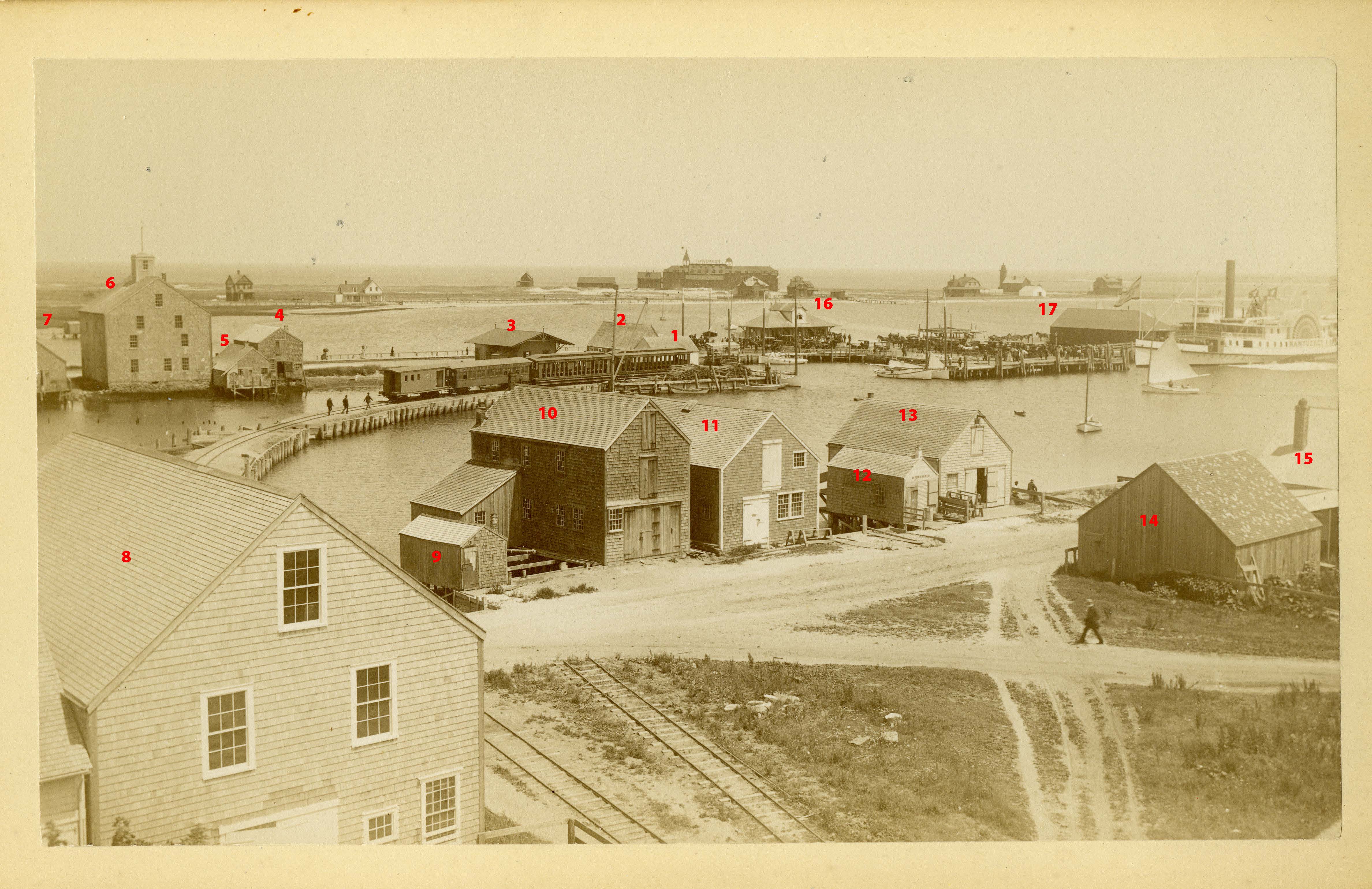
Goal 1: Harbor Visualization | Steamboat Wharf
The client wanted to show museum-goers what it might have looked like to be standing from the rooftop of the Whaling Museum looking out towards the sea in the 19th Century.
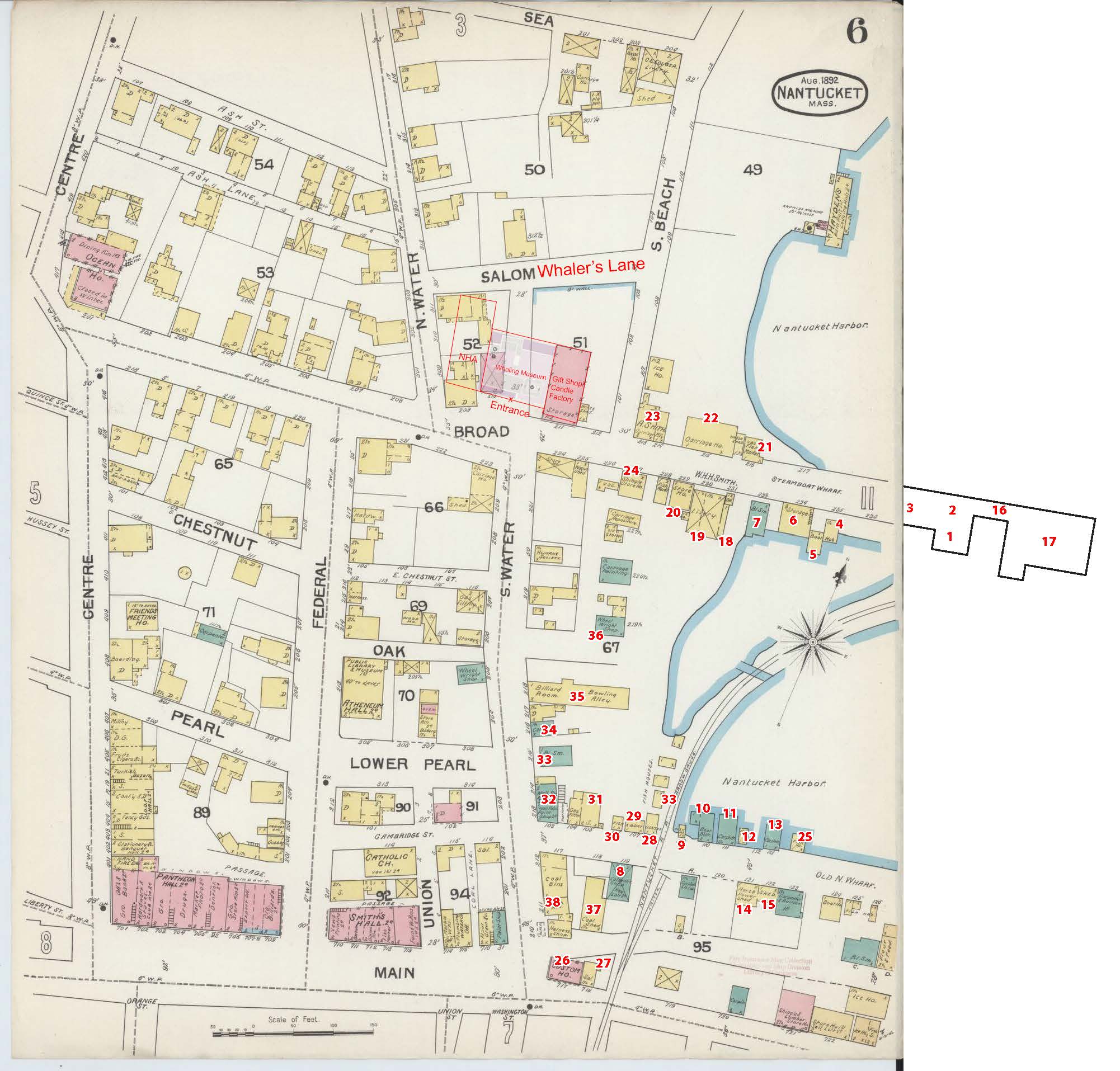
Challenge 1: Find out which buildings went where
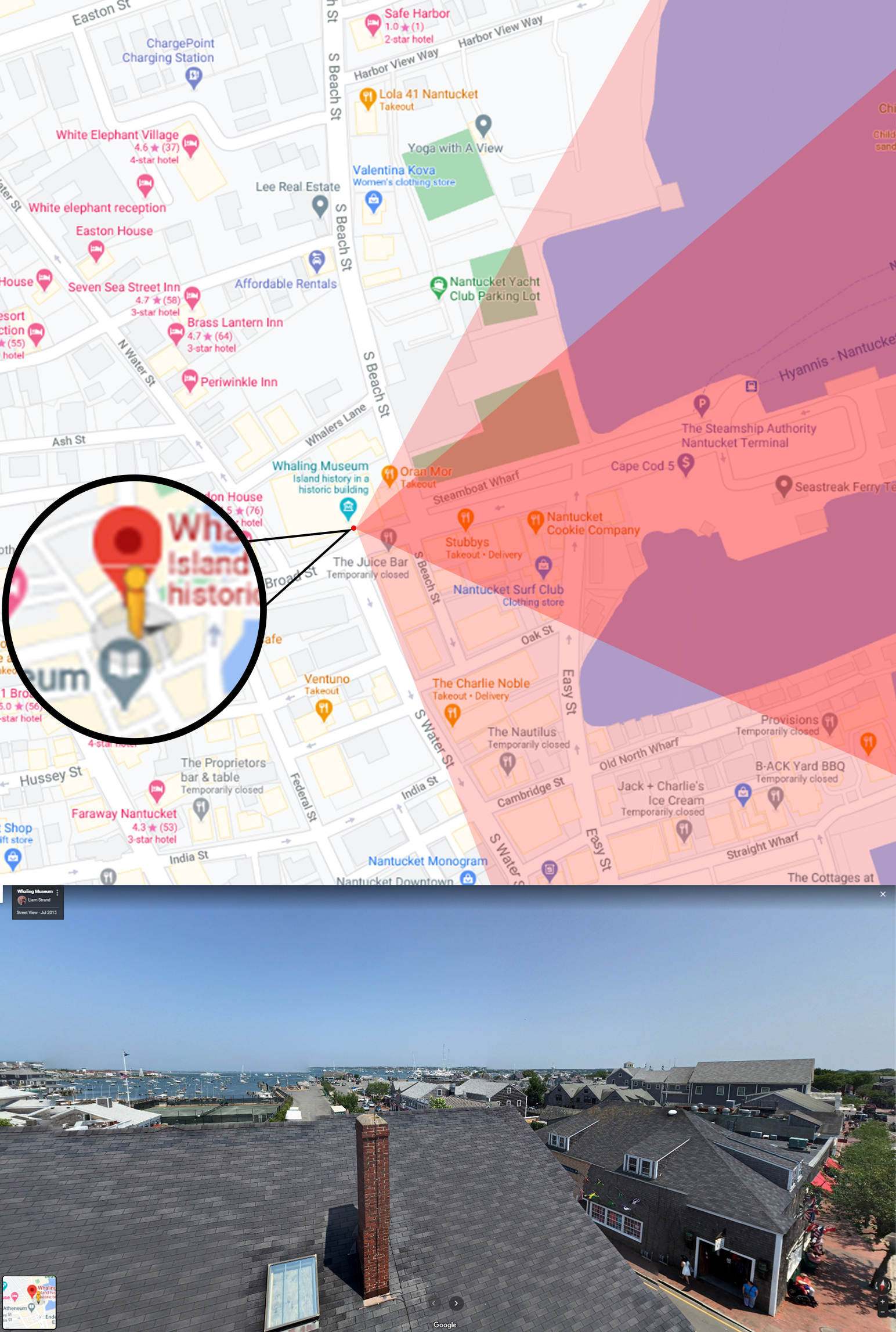
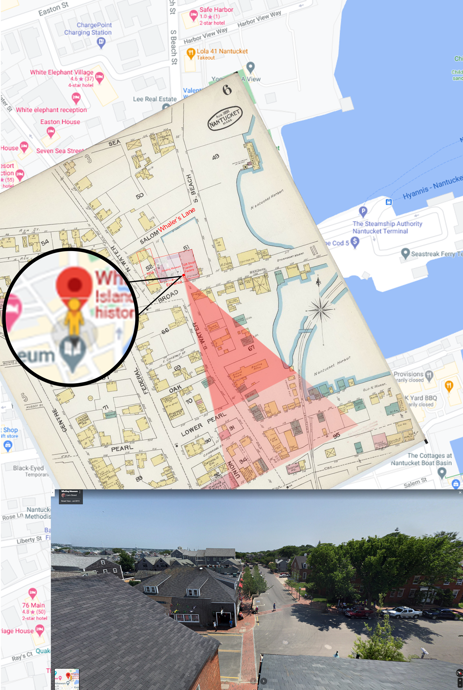


Solution 1: Combine/overlay maps from the 19th century with present-day Google maps of the area.
Combined information/elements included:
︎ Google Maps ︎ Google Street View
︎ 19th Century fire maps ︎19th Century cartographs
Challenge 2: Find out which buildings existed when
︎ I noticed lighthouse in Brant’s Point was in different locations depending on the year that the photos were taken.
This is how I approximated the dates of the unlabeled photos:
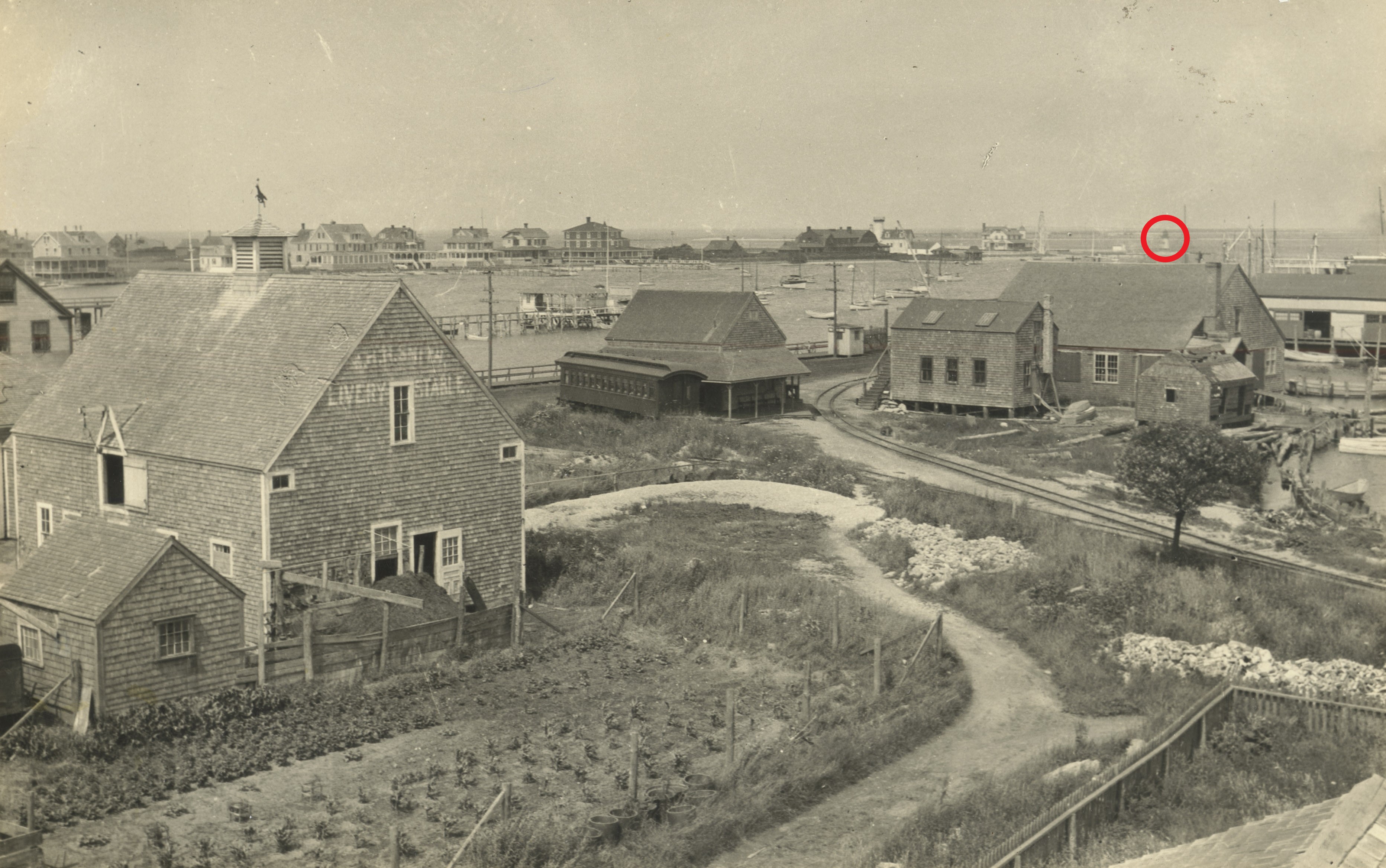


Solution 2: Generate data points based around 1880-1890.
Our team constructed a new map corresponding to exact buildings/placements from the photos we could find.
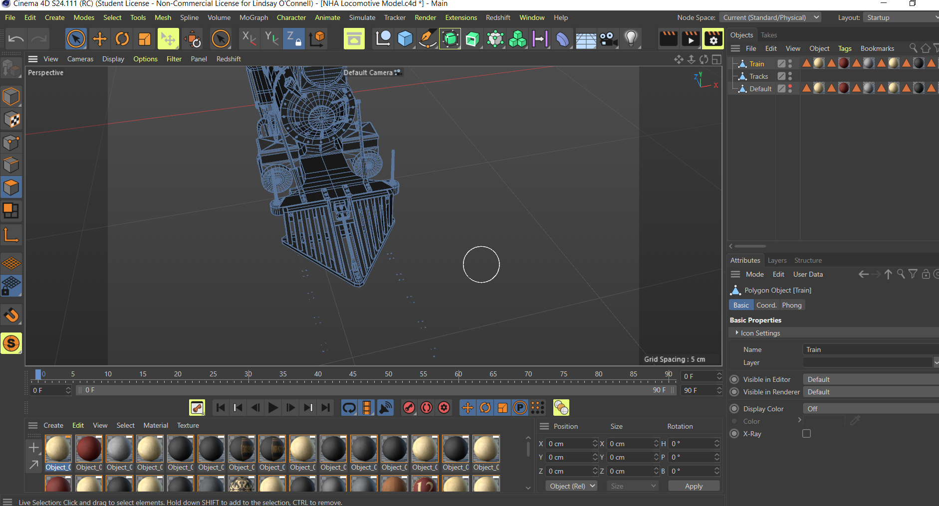
Goal 2: Create a Cinema 4D Render
Using this map, we could then build out the harbor with precision.
The client also provided us with some textures and assets they wished to use:

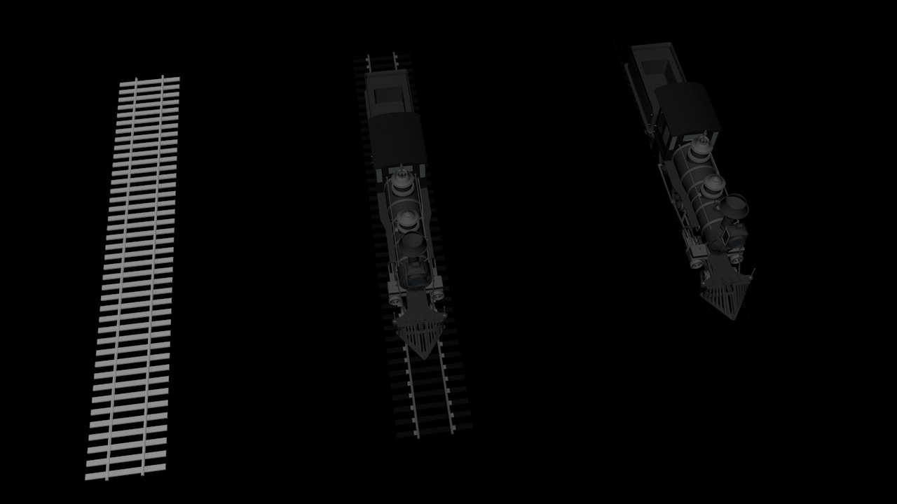
We placed the assets in specific locations based on the photos we had labeled.
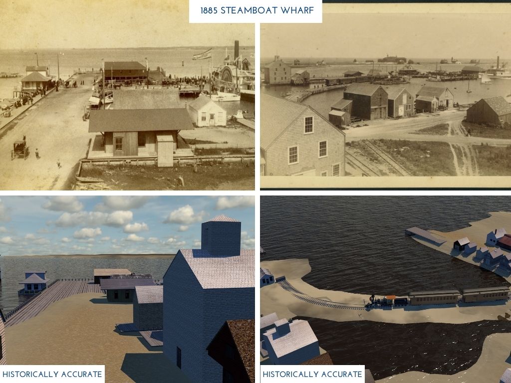
Deliverables: 360° Still Image
Can be viewed an AR viewfinder on the rooftop of the NHA Whaling Museum
OR
Experienced from a VR headset, anywhere.

